Marine Apps
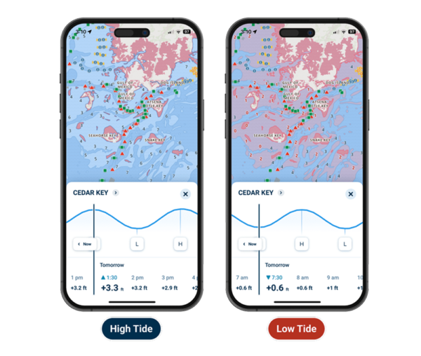
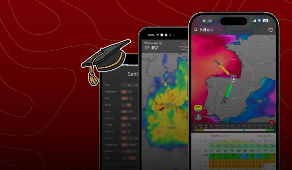
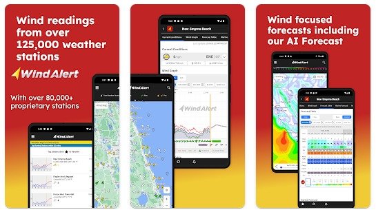
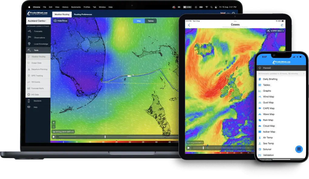
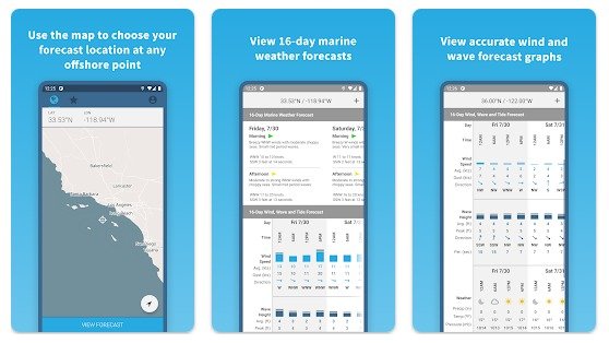
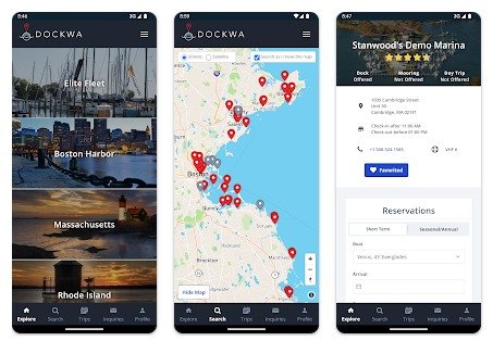
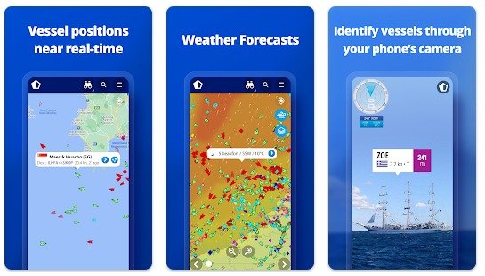
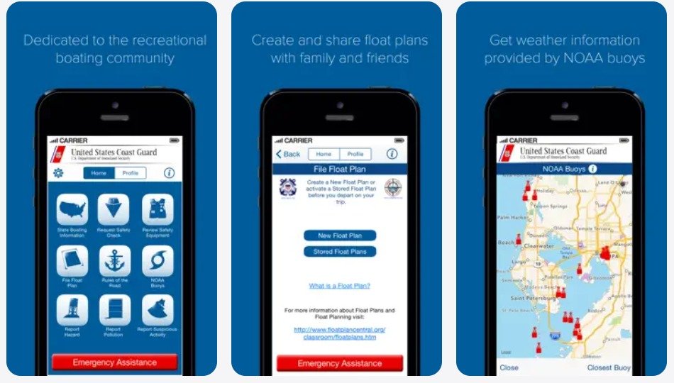
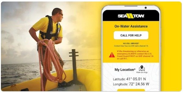
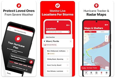
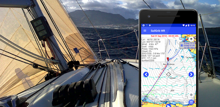
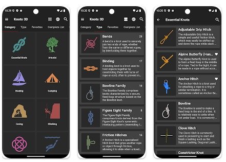
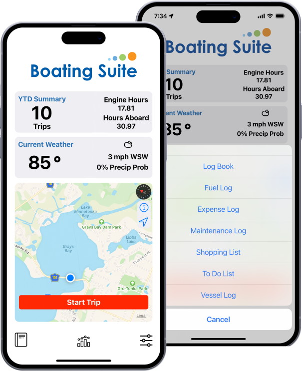
Smart Marine Apps to Make Every Journey Safer and Easier
Discover trusted marine apps designed to support navigation, fishing, sailing, weather tracking, safety, and overall boat management. These digital tools help boaters make informed decisions, improve on-water performance, and stay connected—whether you’re cruising, racing, or fishing offshore.
Navionics Boating App
Navionics® Boating App | For cruising, fishing, sailing, diving and all your other activities on the water, the Navionics Boating app brings detailed offshore marine and inland lake charts to your mobile device.
C-MAP Boating
C-MAP Boating | DISCOVER™ X or REVEAL™ X charts. Gain access to exclusive features like your GPS Position, 5-day Weather Along the Route, Anchoring Alert and more.
Aqua Map
Aqua Map - A marine navigation app designed for smartphones and tablets. It features up-to-date nautical charts, POI displays from ActiveCaptain and Waterway Guide, marine forecasts, AIS target tracking, and Live Sharing.
Argo Navigation App
Argo Navigation App | Find the quickest and safest route for your journey. Argo lets you view and report hazards, local advice, weather, marine life. Connect and share experiences with other boaters. Argo lets you invite friends, plus share your location, places and journeys.
Wave Boating App
Wave Boating App | Navigation & Autorouting | The world’s easiest map for boaters | Automatic Tidal Data | Weather : Find the best time to boat | Community : Find the best spots with help from other boaters
Windy.com
Windy.com is an extraordinary tool for weather forecast visualization. It’s fast, intuitive, detailed and most accurate weather app trusted by professional pilots, paragliders, skydivers, kiters, surfers, boaters, fishermen, storm chasers and weather geeks, and even by governments, army staffs and rescue teams.
WindAlert
WindAlert gives you the weather in your neighborhood, from observations onsite or right next door. With over 65,000 proprietary Tempest Weather Systems deployed, get real-time local weather right where you are. Our Tempest Rapid Refresh Model delivers the most accurate Nearcast predictions to our customers.
NOAA Weather
NOAA Weather | Provide weather, water and climate data, forecasts, warnings, and impact-based decision support services for the protection of life and property and enhancement of the national economy.
PredictWind App
PredictWind App : Marine forecasts and tools for inshore and coastal applications. The PredictWind App and Website are designed for use on cellular and wifi networks. View high resolution forecasts on your mobile, tablet or computer.
Buoyweather
Buoyweather provides the most important information needed to bring joy to your time on the water. Make use of the most accurate marine weather forecasts to plan ahead for your trip offshore. Simply pick any point over water to receive a long range marine weather forecast at that latitude and longitude.
Dockwa
Discover new marinas, view marina amenities and photos, and request and manage marina reservations right from your Android phone or tablet. There are no additional costs to boaters who use Dockwa – all marina prices and policies on the Dockwa platform reflect those set by the marina for all reservations.
Marine Traffic
MarineTraffic displays near real-time positions of ships and yachts worldwide. Connected to the largest network of land-based AIS receivers, the app covers most major ports and shipping routes. • View VESSELS ON THE LIVE MAP, search for ships, boats and seaports and see what's near you!
KnowWake
KnowWake is a FREE marine navigation platform packed with waterfront destinations in the United States, Canada, Caribbean, Mexico, South Africa, United Kingdom, parts of Europe, Arabian Peninsula and NOW all of Australia and New Zealand!!
Active Captain
The free ActiveCaptain app creates a powerful connection between your compatible smart device and Garmin chartplotter, charts, maps and the boating community. Use it to activate your Garmin Navionics+™ or Garmin Navionics Vision+™ subscription, plus download daily updates and premium content.
iNavx
Marine navigation is made easy with iNavX - the world's #1 handheld Chartplotter. Access marine charts, maps, weather, AIS and more! iNavX is the only app to give you complete worldwide chart coverage, from all your favorite charts providers, including the ALL NEW iNavX Professional+ Global Chart! Fully enabled with one-touch access.
Fishing Point
Fishing Points is a fishing app that turns your phone into an ultimate fishing tool. You can save your favourite fishing places (locations, trolling paths and trotlines) and find them using GPS in your phone
U.S. Coast Guard
The U.S. Coast Guard Mobile App | Features of the app include: state boating information; a safety equipment checklist; free boating safety check requests; navigation rules; float plans; and calling features to report pollution or suspicious activity.
Sea Tow App
Sea Tow App | Have Peace of Mind on the Water™ knowing that you can reach Sea Tow directly with just one touch via the Sea Tow Boating app. Identify your location with ease! Your GPS location* is displayed in large, easy-to-read numbers and can be viewed on a map. Share your location via text, email, and more with a tap of a button.
First Aid : Red Cross
Prepare to protect your loved ones with expert tips and tools. As extreme weather events increase, it’s more important than ever to be prepared. The Emergency app helps you and your loved ones before, during, and after a disaster. Access short guides to help you prepare, receive National Weather Service alerts, view live weather maps, and find open Red Cross shelters and services near you.
SailGrib
SailGrib: an app that allows you to get weather grib files from different sources while on earth or at sea. We then added a tidal module such that with a glance, you get the essential parameters of your sailing trip. A Weather Routing software is an incredible tool to optimize sailing routes for the safety of navigation. We’ve simplified it all by creating an app where everything is included – weather, polars, tidal currents – and is still simple to use!
Knots 3D
Our comprehensive library features over 200 animated knots with step-by-step tutorials that transform complex rope work into clear, easy-to-follow instructions that work for complete beginners and serve as a quick reference for experts. Whether you're searching for climbing knots, fishing knots, sailing knots, camping knots, or scouting knots, our interactive platform makes learning how to tie essential knots easier than ever before
The Ultimate DIY Boat and Yacht Management App Provides a convenient and organized way to manage all aspects of boat ownership. With the ability to log trips, fuel, expenses, and maintenance, as well as maintain to-do and shopping lists.